Log in
All resources
Create a design
Tools
402 Free Images of 1880 Maps
maps from the earth and its inhabitants, vol. iv
atlas des anciens plans de paris by imprimerie nationale, 1880 from bhvp
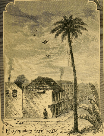
historical sketch book and guide to new orleans and environs (1885)
koizumi yakumo
maps from the earth and its inhabitants, vol. v
maps from the earth and its inhabitants, vol. iii
turgot map of paris, bibliothèque historique de la ville de paris
french quarter in art
too late for gordon and khartoum (1887) by macdonald
maps of the mahdist war
maps from the earth and its inhabitants, vol. iv
1880s maps of the british isles
maps from the earth and its inhabitants, vol. iii
maps of blankenberge
too late for gordon and khartoum (1887) by macdonald
maps of the mahdist war
maps from the earth and its inhabitants, vol. iv
old maps of lincoln
maps from the earth and its inhabitants, vol. iv
old maps of norwich
maps from the earth and its inhabitants, vol. iv
old maps of sheffield
maps from the earth and its inhabitants, vol. iv
old maps of cambridge
maps from the earth and its inhabitants, vol. iv
1880s maps of the british isles
maps from the earth and its inhabitants, vol. iv
1880s maps of scotland
maps from the earth and its inhabitants, vol. iv
1880s maps of ireland
maps from the earth and its inhabitants, vol. iv
1880s maps of the british isles
ghosts & ghoulish scenes
maps from the earth and its inhabitants, vol. iv
1881 maps
maps from the earth and its inhabitants, vol. xviii
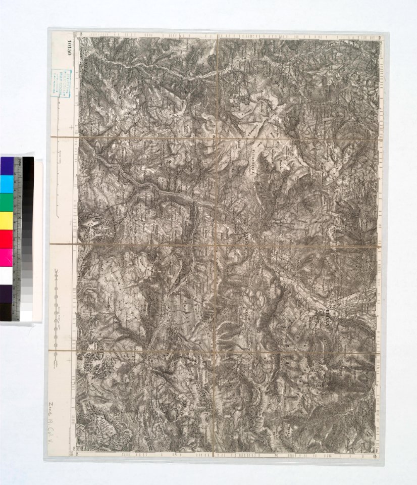
1890s maps of colombia
maps from the earth and its inhabitants, vol. iv
1882 maps
too late for gordon and khartoum (1887) by macdonald
maps of the mahdist war
maps from the earth and its inhabitants, vol. v
19th-century maps of crimea
maps from the earth and its inhabitants, vol. iv
old maps of lincoln
maps from the earth and its inhabitants, vol. v
19th-century maps of scandinavia
maps from the earth and its inhabitants, vol. v
old maps of the dnieper river
maps from the earth and its inhabitants, vol. iv
19th-century maps of the isle of man
maps from the earth and its inhabitants, vol. x
old maps of ethiopia
atlas des anciens plans de paris by imprimerie nationale, 1880 from bhvp
baroque
maps from the earth and its inhabitants, vol. iv
19th-century maps of the isle of wight
maps from the earth and its inhabitants, vol. iv
old maps of portsmouth
maps from the earth and its inhabitants, vol. iv
old maps of the isles of scilly
maps from the earth and its inhabitants, vol. iii
19th-century maps of europe
maps from the earth and its inhabitants, vol. v
old maps of the black sea
maps from the earth and its inhabitants, vol. iv
old maps of the isle of arran
maps from the earth and its inhabitants, vol. iii
old city maps of munich
maps from the earth and its inhabitants, vol. iv
old maps of sheffield
maps from the earth and its inhabitants, vol. iv
old maps of cromartyshire
maps from the earth and its inhabitants, vol. iii
old maps of trier
maps from the earth and its inhabitants, vol. iv
old maps of derby
maps from the earth and its inhabitants, vol. v
19th-century maps of crimea
maps from the earth and its inhabitants, vol. iv
old maps of norwich
old maps of the franco-prussian war
alfred quesnay de beaurepaire
cassell's old and new edinburgh (1880s)
holyrood palace
nouveau cours d'instruction primaire de géographie (1886)
1880s maps of the americas
too late for gordon and khartoum (1887) by macdonald
maps of the mahdist war
too late for gordon and khartoum (1887) by macdonald
maps of the mahdist war
atlas des anciens plans de paris by imprimerie nationale, 1880 from bhvp
dheulland map of paris
atlas des anciens plans de paris by imprimerie nationale, 1880 from bhvp
dheulland map of paris
atlas des anciens plans de paris by imprimerie nationale, 1880 from bhvp
proletarian literature
atlas des anciens plans de paris by imprimerie nationale, 1880 from bhvp
plan de turgot
atlas des anciens plans de paris by imprimerie nationale, 1880 from bhvp
romanticism
maps from the earth and its inhabitants, vol. iv
atlas des anciens plans de paris by imprimerie nationale, 1880 from bhvp
turgot map of paris, bibliothèque historique de la ville de paris
1100 block of royal street, french quarter
1885 in new orleans
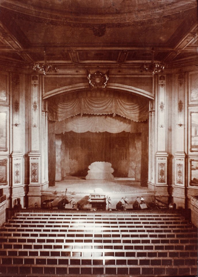
brooklyn bridge – city hall (irt lexington avenue line)
the street railway journal (1904)
atlas des anciens plans de paris by imprimerie nationale, 1880 from bhvp
turgot map of paris, bibliothèque historique de la ville de paris
atlas des anciens plans de paris by imprimerie nationale, 1880 from bhvp
turgot map of paris, bibliothèque historique de la ville de paris
atlas des anciens plans de paris by imprimerie nationale, 1880 from bhvp
turgot map of paris, bibliothèque historique de la ville de paris
atlas des anciens plans de paris by imprimerie nationale, 1880 from bhvp
baroque
europe in storm and calm (1885)
1885 maps of europe
swamps in louisiana
1885 in louisiana
engravings in musée carnavalet
plan de turgot
orleans street, french quarter
arecaceae in new orleans
historical sketch book and guide to new orleans and environs (1885)
madame john's legacy
historical sketch book and guide to new orleans and environs (1885)
dueling oaks, new orleans
royal street, french quarter
cafés in new orleans
lutetia parisiorum urbs, toto orbe celeberrima notissimaque caput regni franciæ by sebastian münster
atlas des anciens plans de paris by imprimerie nationale, 1880 from bhvp
houses in the french quarter
koizumi yakumo
historical sketch book and guide to new orleans and environs (1885)
houses in new orleans
vegas färd kring asien och europa
fra mauro map derivative works
birds-eye view of seattle, 1884
ships in puget sound
historical
history
historical
history
maps from the earth and its inhabitants, vol. iv
maps from the earth and its inhabitants, vol. v
velikiy novgorod
maps from the earth and its inhabitants, vol. iv
maps from the earth and its inhabitants, vol. iv
middlesbrough
maps from the earth and its inhabitants, vol. iv
maps from the earth and its inhabitants, vol. iv
maps from the earth and its inhabitants, vol. iv
maps from the earth and its inhabitants, vol. iv
maps from the earth and its inhabitants, vol. iv
maps from the earth and its inhabitants, vol. iv
maps from the earth and its inhabitants, vol. iv
maps from the earth and its inhabitants, vol. iv
historical sketch book and guide to new orleans and environs (1885)
koizumi yakumo
historical sketch book and guide to new orleans and environs (1885)
koizumi yakumo
historical sketch book and guide to new orleans and environs (1885)
koizumi yakumo
dr. wilh. junker's reisen in afrika 1875-1886
1880s maps of egypt
maps from the earth and its inhabitants, vol. iv
toyohara chikanobu
ukiyo-e
maps from the earth and its inhabitants, vol. v
maps from the earth and its inhabitants, vol. iii
monnickendam
french quarter in art
1885 in new orleans
la hongrie de l'adriatique au danube. impressions de voyage (1883)
1880s maps of austria-hungary
la hongrie de l'adriatique au danube. impressions de voyage (1883)
1880s maps of austria-hungary
yachts and yachting - with over one hundred and ten illustrations (1887)
19th-century maps of the british isles
historical
history
maps in the rijksmuseum amsterdam
emrik & binger
carte de l'afrique françoise par guillaume delisle (1726)
philippe buache
nineveh and babylon - a narrative of a second expedition to assyria during the years 1849, 1850, and 1851 (1882)
maps of babylon
nineveh and babylon - a narrative of a second expedition to assyria during the years 1849, 1850, and 1851 (1882)
maps of nimrud
nineveh and babylon - a narrative of a second expedition to assyria during the years 1849, 1850, and 1851 (1882)
maps of babylon
the geographical distribution of the family charadriidae (1888)
distribution maps needing taxon category
the soldier in our civil war - western theater
bird's eye view maps of tennessee
301 - 400 of 402
Next page
/ 5